Media playback is unsupported on your device
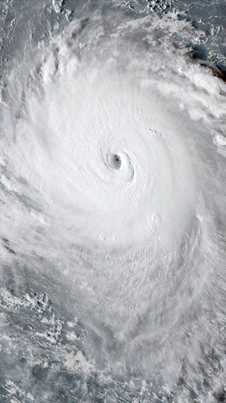
A powerful storm that is threatening Florida and the Bahamas has strengthened to category four, the US National Hurricane Center (NHC) says.
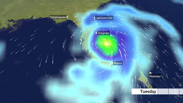
Hurricane Dorian has maximum sustained winds of nearly 140mph (220km/h).
It is expected to grow even stronger as it passes the north-west Bahamas before making landfall in Florida early next week.
Reports from the Bahamas described tourists scrambling to leave before the closure of the international airport.
A state of emergency has been declared in Florida, where residents have been urged to stock enough food, water and medicine to last at least a week.
Forecasters warn Dorian could be the state's worst storm since category five Hurricane Andrew killed 65 people and destroyed 63,000 homes in 1992.
Hurricanes tend to get stronger as they move over warm water like that off the Florida coast.
What's the forecast?
"Dorian is anticipated to remain an extremely dangerous major hurricane while it moves near the north-western Bahamas and approaches the Florida peninsula into early next week," the NHC said.
Media playback is unsupported on your device
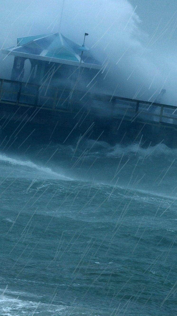
The NHC warned in an earlier briefing that Dorian could cause "incredibly catastrophic damage" and life-threatening storm surges.
Hurricane Dorian's exact path toward Florida remains unclear but millions of people could be affected, as well as holiday attractions such as Walt Disney World and President Donald Trump's Mar-a-Lago resort.
Dorian is expected to drop up to 12in (30cm) of rain on the coastal US, with some areas getting as much as 18in. Tides in the region are already at some of their highest levels of the year, owing to a naturally occurring event.
A new moon, combined with the coming autumn equinox, has created what are known in Florida as "king tides". Forecasters warn this is likely to exacerbate dangerous levels of flooding.
How is Florida preparing?
Florida's Governor Ron DeSantis has declared a state of emergency for the whole state, as has President Trump. The governor has activated 2,500 National Guard troops, with another 1,500 on standby.
Shoppers in Florida have been queuing around the block to snap up supplies such as medication and fuel. Some petrol stations reported fuel shortages, while a few shops had run out of bottled water.
No immediate mass evacuations have been ordered by state authorities but President Trump, who had warned that Dorian "could be an absolute monster", said a decision could be made on Sunday.
People have been asked to bring their pets with them in case of evacuation. On social media, the names of hotels that accept pets are being shared.
Orlando International Airport announced that it was halting commercial flights from 02:00 (06:00 GMT) on Monday "out of an abundance of caution". Tourist resorts in the city remained open, however.
President Trump cancelled a planned trip to Poland because of the storm, sending Vice-President Mike Pence instead.
What about the Bahamas?
The NHC has issued a hurricane warning for the north-western Bahamas where water levels could raise by as much as 10-15ft (3-4.5m) in some areas.
Near the coast, it said, the surge would be accompanied by large and destructive waves.
Bahamas Prime Minister Hubert Minnis announced an evacuation order for parts of Grand Bahama and the Abaco Islands, both in the north of the archipelago, and said flights were being increased.
"I'm appealing to residents who are able to [leave] to seek shelter among family members and other suitable accommodations for their safety," he said in a news conference.
"I urge you, do not be foolish and try to brave out this hurricane. The price you may pay for not evacuating is your life or other serious physical harm," he said.
Hurricanes
A guide to the world's deadliest storms
Hurricanes are violent storms that can bring devastation to coastal areas, threatening lives, homes and businesses.

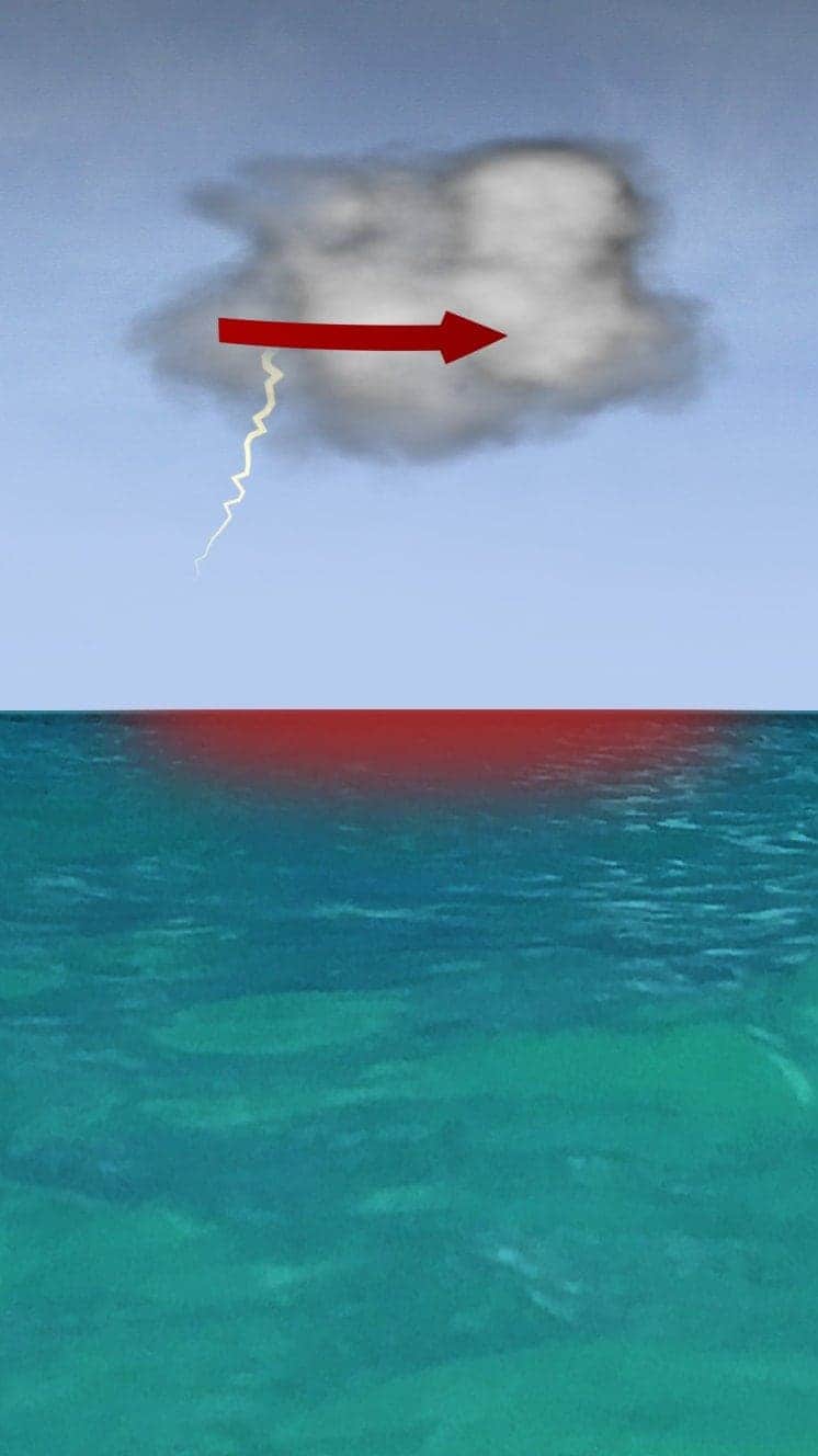
Hurricanes develop from thunderstorms, fuelled by warm, moist air as they cross sub-tropical waters.
Warm air rises into the storm.
Air swirls in to fill the low pressure in the storm, sucking air in and upwards, reinforcing the low pressure.
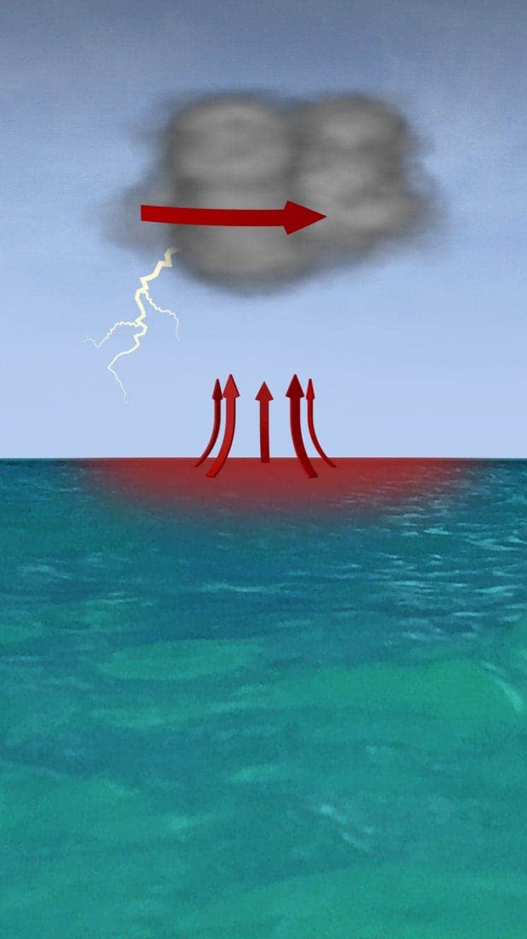
The storm rotates due to the spin of the earth and energy from the warm ocean increases wind speeds as it builds.
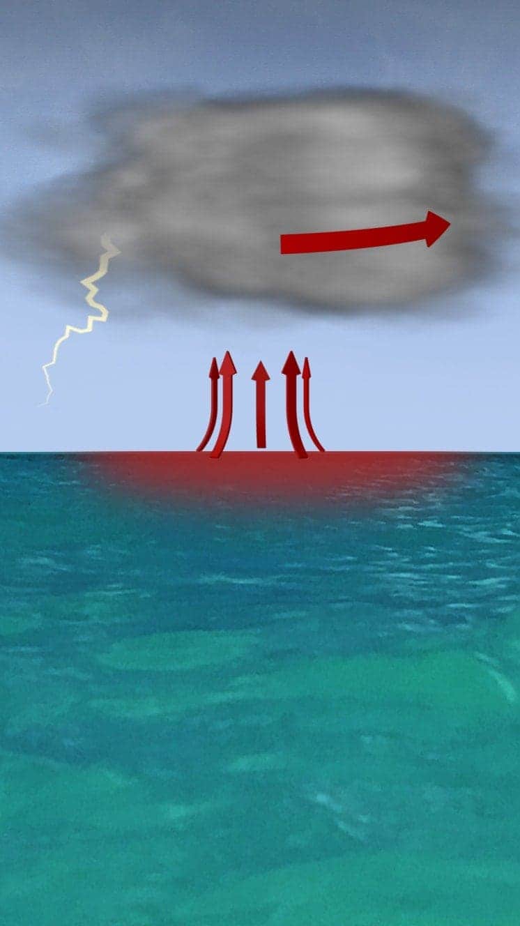
When winds reach 119km/h (74mph), it is known as a hurricane – in the Atlantic and Eastern Pacific – or a typhoon in the Western Pacific.

"Everybody has a plan until they get punched in the face. Well, we're about to get punched in the face."
Florida Mayor Bob Buckhorn, ahead of Hurricane Irma (2017)
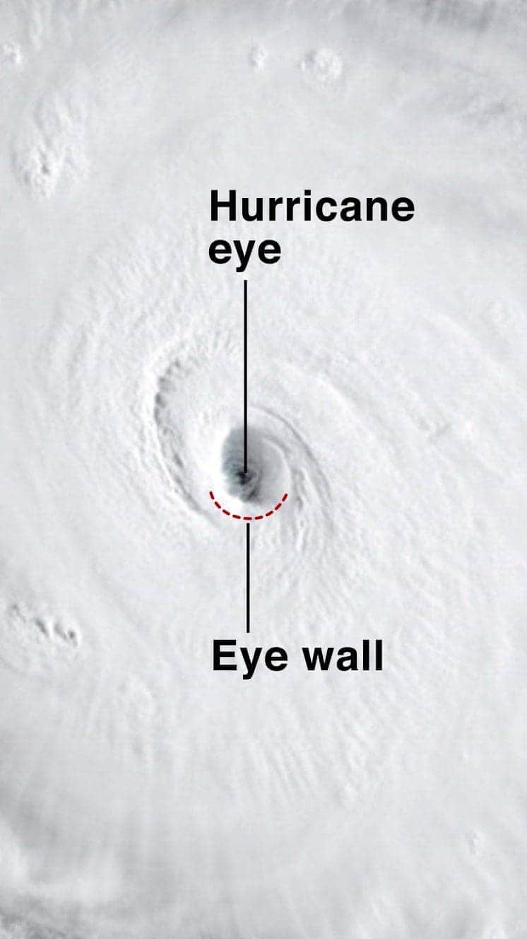
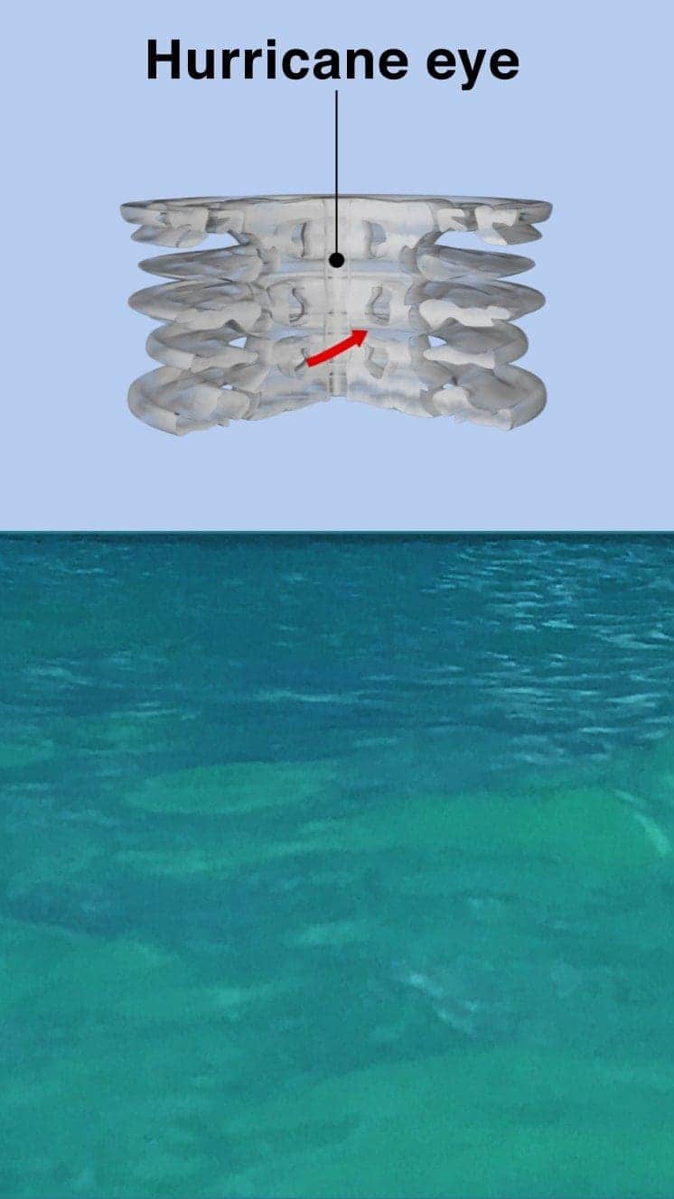
The central eye of calmer weather is surrounded by a wall of rainstorms.
This eyewall has the fastest winds below it and violent currents of air rising through it.
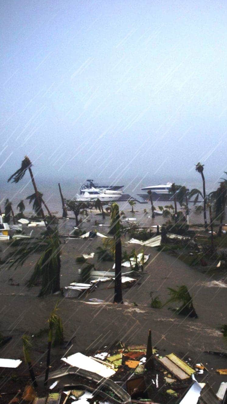
A mound of water piles up below the eye which is unleashed as the storm reaches land.
These storm surges can cause more damage from flooding than the winds.

"Urgent warning about the rapid rise of water on the SW FL coast with the passage of #Irma's eye. MOVE AWAY FROM THE WATER!"
Tweet from the National Hurricane Center
The size of hurricanes is mainly measured by the Saffir-Simpson scale – other scales are used in Asia Pacific and Australia.
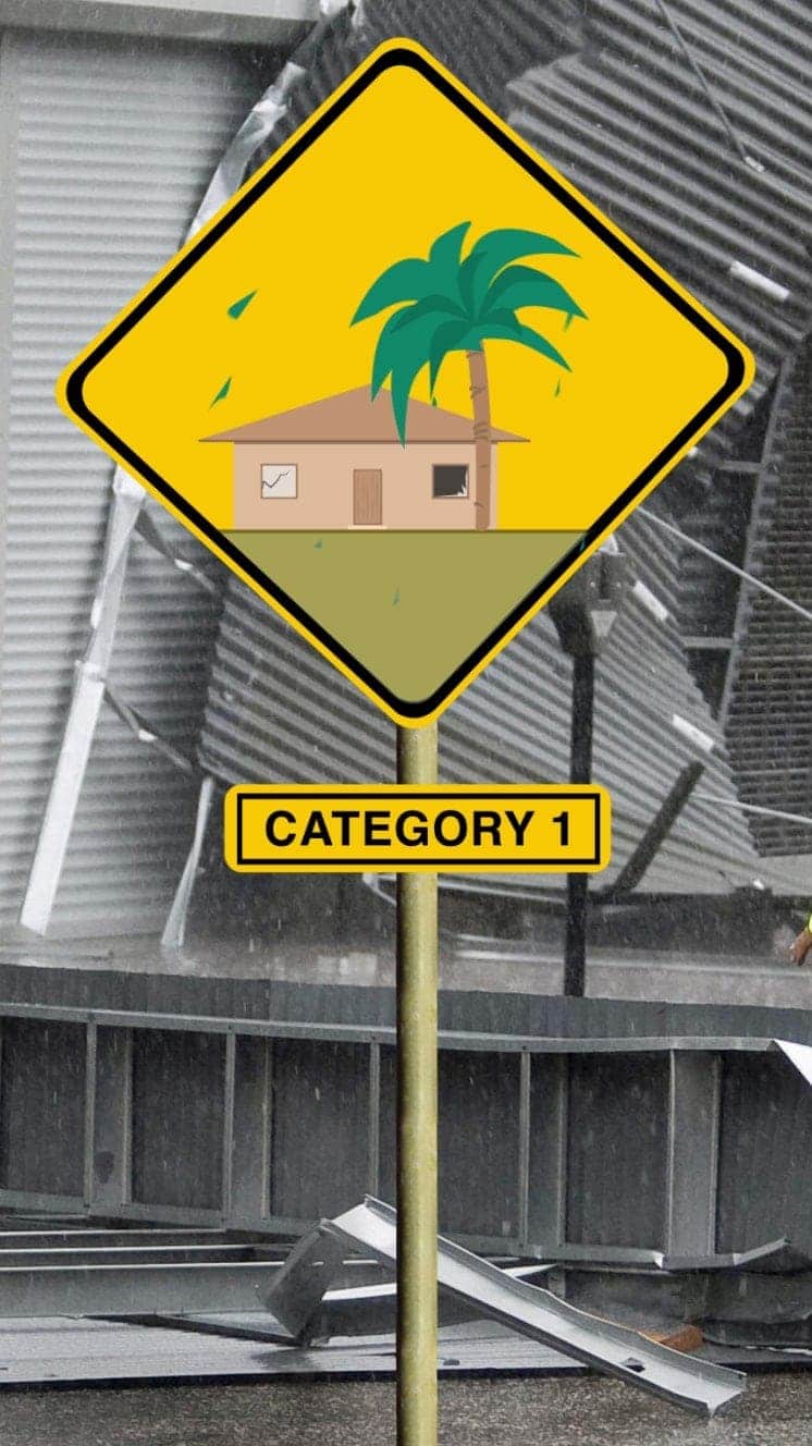
Winds 119-153km/h
Some minor flooding, little structural damage.
Storm surge +1.2m-1.5m
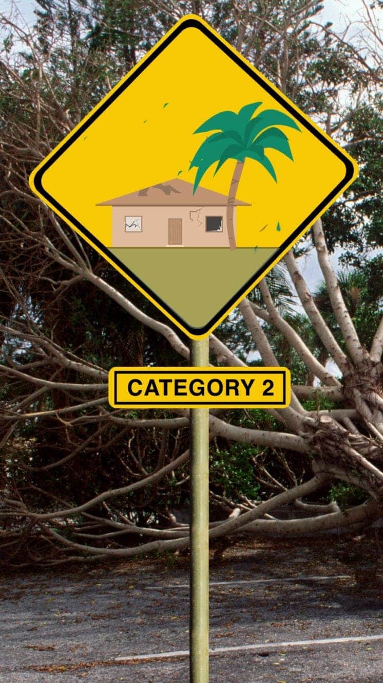
Winds 154-177km/h
Roofs and trees could be damaged.
Storm surge +1.8m-2.4m
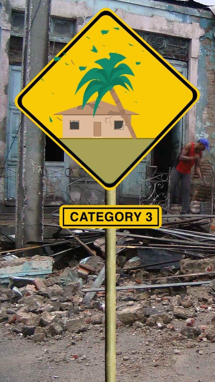
Winds 178-208km/h
Houses suffer dRead More – Source